Winter Weather Storytelling Tips for Broadcast Meteorologists

When it comes to winter weather, viewers want to know what type of precipitation is falling, how much has fallen, how much more will fall, how the roads are affected, and ultimately whether or not there will be school tomorrow.
While they can’t answer the last question, broadcast meteorologists and local TV station weather teams can provide viewers with valuable information to help them plan their day and keep them safe.
Use the data to tell a story
Meteorological data vendors like The Weather Company* produce over 70 different products for local television stations, enabling broadcast meteorologists to creatively combine weather data into dynamic visualizations that tell engaging weather stories. Here are a few examples.
READ MORE > 10 THINGS MORE INTERESTING THAN A SATRAD LOOP
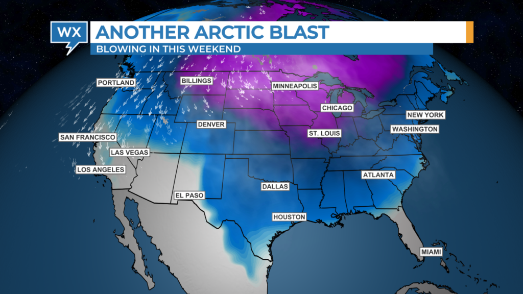
Combine custom color tables with the upper-level wind flow and low-level temperatures to show the movement of massive amounts of cold air.
Dynamically track wintery precipitation
Winter precipitation can significantly affect travel. For these types of weather events, broadcast meteorologists might use a special Earth design that displays more interstates and highways than normal.
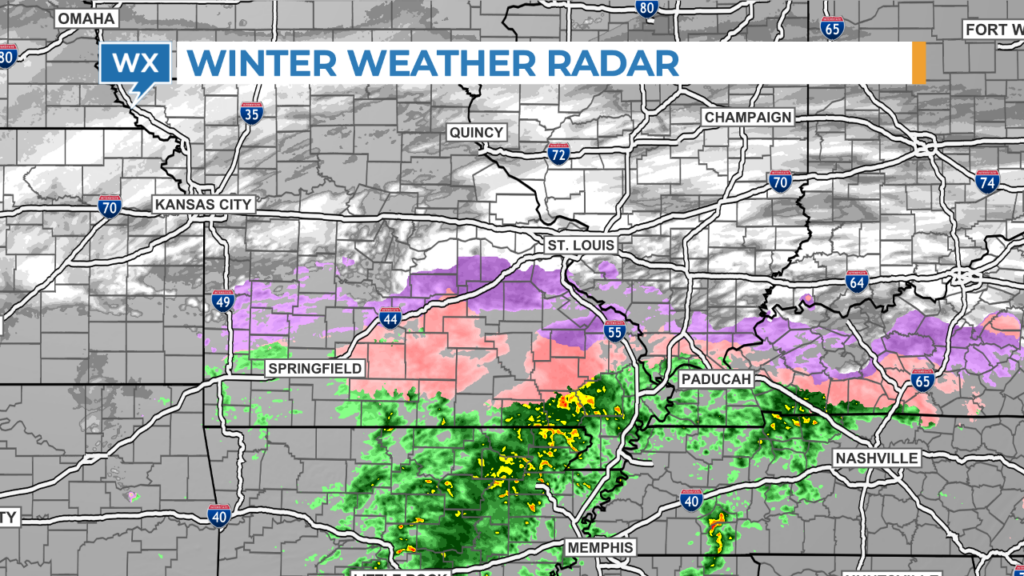
Major winter weather events often produce many different types of weather threats and many different types of weather alerts depending on the number of National Weather Service offices serving the local area. Uncomplicate weather alerts using a simpler color scheme and a special query tool that only displays the warning types.

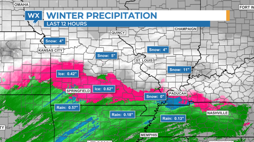
Keep your viewers updated on how much precipitation has accumulated using the RainVision, SnowVision, and IceVision data products available exclusively from The Weather Company. To enable immediate data queries, create a custom query tool and select it as the Default Tool for the Vision data products saved in the interactive panel.
Combine the Road Weather Index from The Weather Company with traffic incident reports to illustrate how rain, freezing rain, sleet, and snow affect local travel.
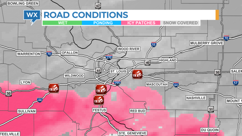
The Road Weather Index is also available on weather apps developed for local TV stations by The Weather Company. Remind viewers to check the road conditions before venturing out.
Provide eyewitness updates on road conditions
Max Velocity software developed by The Weather Company allows broadcast meteorologists to report live or record digital updates from inside a roving news vehicle using a simple laptop.
Take advantage of the dynamic mapping and zoom into specific streets and highways while showing the last radar and weather conditions.
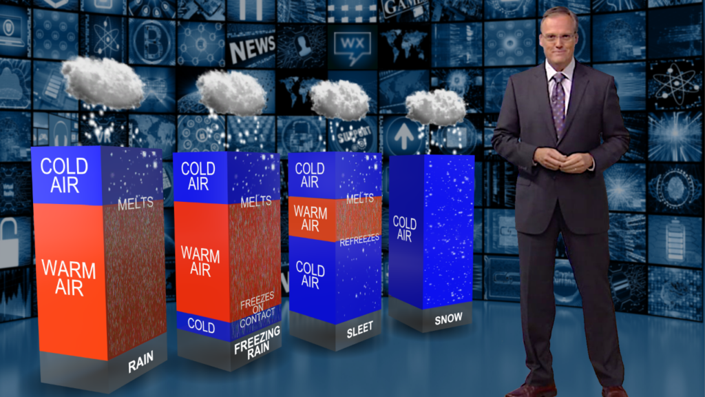
Explain how different types of winter precipitation form
It can be difficult to explain why different types of wintery precipitation form and why those types might change over time. Download the Winter Precip Types scene from The Weather Community website (log-in required) and use it with Max Reality, the augmented reality software originated by The Weather Company. This scene dynamically explains how different temperatures aloft and near the ground determine the types of precipitation that might fall from the sky.
Here are some other downloadable scenes from The Weather Company that could easily be converted into Max Reality scenes:
Effectively communicating threats and impacts of winter weather requires the right data used at the right time. Broadcaster meteorologists can provide valuable information to help viewers navigate challenging conditions by utilizing the full capabilities of the on-air graphics system. Engaging visuals and interactive elements not only enhance storytelling but also empower the audience to make informed decisions. By prioritizing safety, local TV station weather teams foster trust and reliability during winter storms, serving their community’s needs while building a loyal audience on-air and online.
*HellerWeather has a marketing and training partnership with The Weather Company. If your weather team needs assistance developing a winter weather coverage plan and setting up the graphics workspace for success, Talk to Tim.
Tim Heller is an AMS Certified Broadcast Meteorologist and Weather Communications Coach. He helps local TV stations and broadcast meteorologists communicate more effectively and work more efficiently.